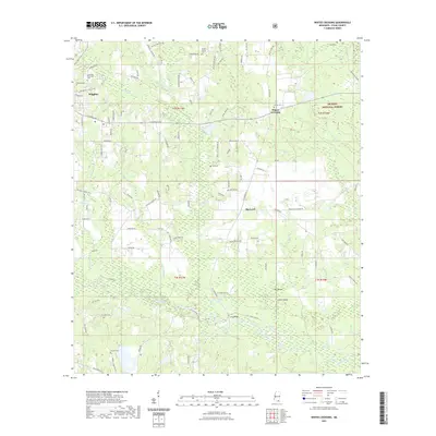
2021 Map of Whites Crossing
USGS Topo · Published 2021About this map
Wiggins serves as the primary municipal hub in the northwest corner of this quadrangle, where the Kansas City Southern railroad line and major thoroughfares like E Central Ave converge. Moving eastward into the De Soto National Forest, the landscape transitions into a network of creek drainages and smaller rural nodes such as Whites Crossing and Big Level. The southern half of the map is defined by the winding course of Red Creek, which creates distinct landforms including Big Island and Little Island. Genealogy and local history are particularly well-represented through numerous family-named burial grounds like Taylor Cem, Bond Cem, and Sumrall Cem. The prevalence of named water features like Sand Ridge Lake, Fish Lake, and Blue Lake highlights the importance of the regional watershed in this part of Stone County.
Find a feature on this map
110 named features on this map. Tap any name to fly to it.
Don’t see what you’re looking for? This feature index may not catch every label — zoom into the map to look around manually.
Map Details
Editions of this 2021 Whites Crossing Map
This is the sole edition of this map. No revisions or reprints were ever made.
Other maps of this area

1947 · Wiggins
USGS Topo · 1:62,500

1947 · Benndale
USGS Topo · 1:62,500

1949 · Wiggins
USGS Topo · 1:62,500

1949 · Benndale
USGS Topo · 1:62,500

1953 · Mobile
USGS Topo · 1:250,000

1954 · Vestry
USGS Topo · 1:62,500

1954 · McHenry
USGS Topo · 1:62,500

1957 · Mobile
USGS Topo · 1:250,000

1960 · Mobile
USGS Topo · 1:250,000

1963 · Mobile
USGS Topo · 1:250,000