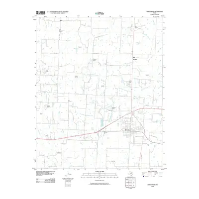
2010 Map of Whitesboro
USGS Topo · Published 2010About this map
Whitesboro serves as the focal point of this North Texas survey, where the convergence of major roadways and rail lines anchors the surrounding agricultural and industrial landscape. The map details an area defined by its energy production and hydrology, with numerous named petroleum sites such as the Whitesboro Oil Field and the Shelden Oil Field scattered across the countryside. The terrain is drained by the extensive network of the Big Mineral Creek system, including its north and south branches, which feed into local impoundments like Bing Lake.
Find a feature on this map
88 named features on this map. Tap any name to fly to it.
Don’t see what you’re looking for? This feature index may not catch every label — zoom into the map to look around manually.
Map Details
Editions of this 2010 Whitesboro Map
This is the sole edition of this map. No revisions or reprints were ever made.
Other maps of this area

1901 · Denison
USGS Topo · 1:125,000

1902 · Gainesville
USGS Topo · 1:125,000

1943 · Gainesville
USGS Topo · 1:125,000

1954 · Sherman
USGS Topo · 1:250,000

1958 · Gordonville
USGS Topo · 1:62,500

1958 · Whitesboro
USGS Topo · 1:62,500

1958 · Sherman
USGS Topo · 1:250,000

1960 · Callisburg
USGS Topo · 1:24,000

1960 · Woodbine
USGS Topo · 1:24,000
1968 · Horseshoe Bend
USGS Topo · 1:24,000