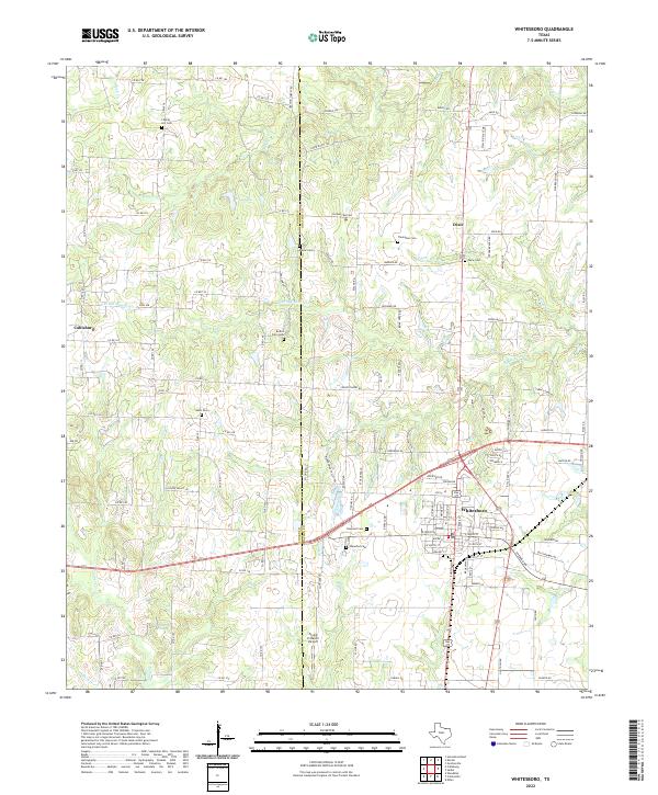
2022 Map of Whitesboro
USGS Topo · Published 2022About this map
Whitesboro serves as the central hub of this North Texas landscape, where the street grid of the town center transitions into a patchwork of rural roads and family cemeteries. The terrain is defined by the drainage of Big Mineral Cr and its various branches, which carve through the countryside between Whitesboro and smaller settlements like Callisburg and Dixie. Genealogists will find a wealth of local history in the numerous burial sites scattered across the map, from large town plots like Oakwood Cem to smaller family landmarks such as Boston Farm Cem and Thompson Cem. The area’s ranching and agricultural character is evident in naming conventions like Chisum Trail Rd and Good Night Trl, alongside modern rural infrastructure such as the Flying H Ranch Airport.
Find a feature on this map
121 named features on this map. Tap any name to fly to it.
Don’t see what you’re looking for? This feature index may not catch every label — zoom into the map to look around manually.
Map Details
Editions of this 2022 Whitesboro Map
This is the sole edition of this map. No revisions or reprints were ever made.
Other maps of this area

1901 · Denison
USGS Topo · 1:125,000

1902 · Gainesville
USGS Topo · 1:125,000

1943 · Gainesville
USGS Topo · 1:125,000

1954 · Sherman
USGS Topo · 1:250,000

1958 · Gordonville
USGS Topo · 1:62,500

1958 · Whitesboro
USGS Topo · 1:62,500

1958 · Sherman
USGS Topo · 1:250,000

1960 · Callisburg
USGS Topo · 1:24,000

1960 · Woodbine
USGS Topo · 1:24,000
1968 · Horseshoe Bend
USGS Topo · 1:24,000