
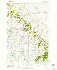
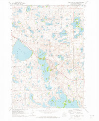
1970 Map of Whitestone Lake
USGS Topo · Published 1973About this map
The Sisseton Indian Reservation encompasses this entire 1970 landscape, where the deeply incised ravines of Long Hollow and Sieche Hollow create a dramatic contrast to the surrounding prairie. Within these drainages, Sieche Hollow State Park protects the unique geography of the Coteau des Prairies. The map reveals a community centered around faith and memory, with several rural landmarks such as St Benedict Ch and its accompanying St Benedict Cem, along with Hope Ch and Spring Valley Cem.
Find a feature on this map
25 named features on this map. Tap any name to fly to it.
Don’t see what you’re looking for? This feature index may not catch every label — zoom into the map to look around manually.
Map Details
Editions of this 1970 Whitestone Lake Map
This is the sole edition of this map. No revisions or reprints were ever made.
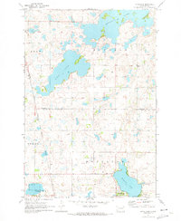
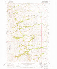
Other maps of this area

1953 · Milbank
USGS Topo · 1:250,000

1958 · Milbank
USGS Topo · 1:250,000
1958 · Veblen
USGS Topo · 1:24,000
1964 · Claire City
USGS Topo · 1:24,000
1964 · Claire City SW
USGS Topo · 1:24,000
1970 · Sisseton
USGS Topo · 1:24,000
1970 · South Red Iron Lake
USGS Topo · 1:24,000
1970 · Piyas Lake
USGS Topo · 1:24,000
1970 · Goodwill
USGS Topo · 1:24,000

1970 · Drywood Lakes
USGS Topo · 1:24,000
Featured Places
- Long Hollow, Long Hollow District
- Old Agency District, SD
- Clear Lake, SD
- Heipa District
- Long Hollow District, SD