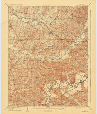
1909 Map of Whitesville
USGS Topo · Published 1935About this map
Whitesville serves as the focal point for this early twentieth-century landscape, situated along the Owensboro Road where the hills of Daviess and Ohio counties meet. The region is defined by a dense network of country schools and rural churches, such as Honeywell Church and St Thomas Church, reflecting the established community fabric of the era. The hydrology of the area is particularly detailed, tracing the meandering path of the Rough River in the south and the branching forks of Panther Creek to the north.
Find a feature on this map
93 named features on this map. Tap any name to fly to it.
Don’t see what you’re looking for? This feature index may not catch every label — zoom into the map to look around manually.
Map Details
Editions of this 1909 Whitesville Map
2 editions found
Other maps of this area

1901 · Owensboro
USGS Topo · 1:62,500

1903 · Tell City
USGS Topo · 1:62,500

1906 · Sutherland
USGS Topo · 1:62,500

1907 · Whitesville
USGS Topo · 1:62,500

1909 · Whitesville
USGS Topo · 1:62,500

1909 · Hartford
USGS Topo · 1:62,500

1909 · Central City
USGS Topo · 1:62,500

1925 · Spring Lick
USGS Topo · 1:62,500

1932 · Fordsville
USGS Topo · 1:62,500

1934 · Cannelton
USGS Topo · 1:62,500