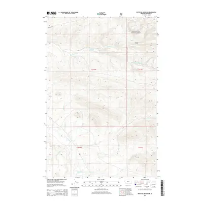
2014 Map of Whitetail Reservoir
USGS Topo · Published 2014About this map
The Smith River flows through this corner of Meagher County, marking a landscape defined by significant water resources and rugged mountain drainages. The map is centered on Whitetail Reservoir, which serves as a central hydrological point for several descending creeks, including Whitetail Deer Cr and the Dry Fork Whitetail Deer Cr. To the northeast, the terrain rises into the Lewis & Clark National Forest, where features like O'Decker Gulch emphasize the steep topography of the region. The map also documents local ranching and transit corridors, notably Horse Prarie Rd and Mt-360. This survey provides a clear view of the complex stream network that feeds the Smith River, including Rabbit Cr and Hatch Cr, which are vital to the area's grazing and forest management history.
Find a feature on this map
19 named features on this map. Tap any name to fly to it.
Don’t see what you’re looking for? This feature index may not catch every label — zoom into the map to look around manually.
Map Details
Editions of this 2014 Whitetail Reservoir Map
This is the sole edition of this map. No revisions or reprints were ever made.
Other maps of this area

1886 · Fort Logan
USGS Topo · 1:250,000

1886 · Little Belt Mts.
USGS Topo · 1:250,000

1894 · Little Belt Mts.
USGS Topo · 1:250,000

1897 · Little Belt Mts.
USGS Topo · 1:250,000

1898 · Little Belt Mts.
USGS Topo · 1:250,000

1902 · Little Belt Mts.
USGS Topo · 1:250,000

1948 · White Sulphur Springs
USGS Topo · 1:250,000

1958 · White Sulphur Springs
USGS Topo · 1:250,000

1961 · White Sulphur Springs
USGS Topo · 1:250,000

1965 · White Sulphur Springs
USGS Topo · 1:250,000