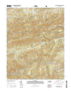
2016 Map of Whitetop Mountain
USGS Topo · Published 2016About this map
Jefferson National Forest dominates this section of the Blue Ridge where the boundaries of Smyth, Grayson, and Washington counties converge. The high-altitude landscape is defined by the Tennessee Valley Divide, with waters like Little Laurel Cr and Big Laurel Cr carving deep drainages between prominent heights such as Chestnut Ridge and Balsam Mtn. Evidence of early Appalachian settlement is scattered throughout these hollows, including the Rowland Creek Cem near Stony Battery and West Cem located along the northern slopes of Barton Mtn. The Appalachian National Scenic Trail winds through the high gaps and ridges, including Hurricane Gap and Deep Gap, tracing a route through what was historically timber and grazing land. The small community of Dry Fork sits at the northwestern edge, situated near the headwaters of the namesake Dry Fork creek.
Find a feature on this map
106 named features on this map. Tap any name to fly to it.
Don’t see what you’re looking for? This feature index may not catch every label — zoom into the map to look around manually.
Map Details
Editions of this 2016 Whitetop Mountain Map
This is the sole edition of this map. No revisions or reprints were ever made.
Other maps of this area

1889 · Wytheville
USGS Topo · 1:125,000

1891 · Abingdon
USGS Topo · 1:125,000

1892 · Wytheville
USGS Topo · 1:125,000

1894 · Abingdon
USGS Topo · 1:125,000

1909 · Abingdon
USGS Topo · 1:96,000

1911 · Abingdon
USGS Topo · 1:125,000

1931 · Rural Retreat
USGS Topo · 1:48,000

1935 · Konnarock
USGS Topo · 1:24,000

1935 · Chilhowie
USGS Topo · 1:24,000

1935 · Mouth of Wilson
USGS Topo · 1:48,000