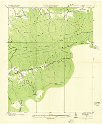
1935 Map of Whitetop Mountain
USGS Topo · Published 1935About this map
Mt Rogers and Whitetop Mtn anchor this high-altitude landscape of Southwest Virginia as it was surveyed in the mid-1930s. The topography is dominated by the sprawling Unaka National Forest, where the Appalachian Trail winds through deep gaps and along the ridgelines of Iron Mountain and Grave Mountain. This era shows the local infrastructure of the Blue Ridge highlands before extensive modern development, with the Jeb Stuart Highway providing one of the few primary routes through the mountains near Barton Gap.
Find a feature on this map
67 named features on this map. Tap any name to fly to it.
Don’t see what you’re looking for? This feature index may not catch every label — zoom into the map to look around manually.
Map Details
Editions of this 1935 Whitetop Mountain Map
This is the sole edition of this map. No revisions or reprints were ever made.
Other maps of this area

1889 · Wytheville
USGS Topo · 1:125,000

1891 · Abingdon
USGS Topo · 1:125,000

1892 · Wytheville
USGS Topo · 1:125,000

1894 · Abingdon
USGS Topo · 1:125,000

1909 · Abingdon
USGS Topo · 1:96,000

1911 · Abingdon
USGS Topo · 1:125,000

1931 · Rural Retreat
USGS Topo · 1:48,000

1935 · Konnarock
USGS Topo · 1:24,000

1935 · Chilhowie
USGS Topo · 1:24,000

1935 · Mouth of Wilson
USGS Topo · 1:48,000