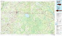
1990 Map of Whiteville
USGS Topo · Published 1990About this map
Lake Waccamaw and the surrounding coastal plains of Columbus Co define this 1990 survey, illustrating a landscape where expansive wetlands meet established agricultural and rail centers. The map documents the intricate hydrology of the region, from the Green Swamp and Crane Savanna to the courses of the Cape Fear River and Lumber River. The hub of Whiteville serves as a primary junction for both the Seaboard Coast Line RR and major highways including Us HWY 74.
Find a feature on this map
110 named features on this map. Tap any name to fly to it.
Don’t see what you’re looking for? This feature index may not catch every label — zoom into the map to look around manually.
Map Details
Editions of this 1990 Whiteville Map
This is the sole edition of this map. No revisions or reprints were ever made.
Other maps of this area

1937 · Nixonville
USGS Topo · 1:48,000

1942 · Burgaw
USGS Topo · 1:62,500

1942 · Nixonville
USGS Topo · 1:62,500

1942 · Wilmington
USGS Topo · 1:62,500

1942 · Juniper Creek
USGS Topo · 1:24,000

1943 · Pages Mill
USGS Topo · 1:62,500

1943 · Pireway
USGS Topo · 1:31,680

1943 · Nakina
USGS Topo · 1:24,000

1943 · Calabash
USGS Topo · 1:31,680

1943 · Funston
USGS Topo · 1:24,000