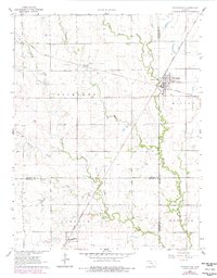
1962 Map of Whitewater
USGS Topo · Published 1978About this map
The town of Whitewater serves as a central hub in this survey, where the Missouri Pacific and Chicago Rock Island and Pacific railroads intersect. This transit-focused landscape in Butler, Harvey, and Sedgwick counties is defined by the drainages of the West Branch Whitewater River and Gypsum Creek. Local history is preserved in the location of the Swiss Cem, Whitewater Cem, and Green Valley Cem, while the industrial footprint of the mid-20th century is evident through an active Oil Field and numerous scattered Oil Wells. Small outposts like Annelly and Furley are situated along the rail lines, illustrating the historical dependence of these prairie settlements on the iron horse for commerce and connectivity. The map also captures the early environmental management of the era with a designated Sewage Disposal site north of the main settlement.
Find a feature on this map
29 named features on this map. Tap any name to fly to it.
Don’t see what you’re looking for? This feature index may not catch every label — zoom into the map to look around manually.
Map Details
Editions of this 1962 Whitewater Map
2 editions found
Other maps of this area

1889 · Newton
USGS Topo · 1:125,000

1889 · Wichita
USGS Topo · 1:125,000

1894 · Wichita
USGS Topo · 1:125,000

1894 · Newton
USGS Topo · 1:125,000

1941 · Valley Center
USGS Topo · 1:31,680

1942 · Valley Center
USGS Topo · 1:31,680

1955 · Benton
USGS Topo · 1:24,000

1955 · Greenwich
USGS Topo · 1:24,000

1955 · Wichita
USGS Topo · 1:250,000

1955 · Hutchinson
USGS Topo · 1:250,000