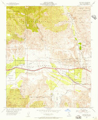
1955 Map of Whitewater
USGS Topo · Published 1956About this map
The San Gorgonio Pass serves as a critical desert corridor on this mid-century survey, dominated by the vital infrastructure of the Colorado River Aqueduct and the Southern Pacific railroad. The landscape is a study in transition, where the arid canyon floors meet the rising slopes of the San Bernardino Mountains. Small settlements and outposts like Bonnie Bell, Fingal, and the White Water PO line the transportation routes, reflecting the localized development of the era. Significant portions of the land are dedicated to the Mission Creek Indian Reservation and the Morongo Indian Reservation, highlighting the area's complex jurisdictional history. From the commercial Whitewater Trout Farm to industrial sites like the Painted Hill Quarry, the map captures the diverse human activity established near the Whitewater River before the heavy expansion of the Coachella Valley.
Find a feature on this map
35 named features on this map. Tap any name to fly to it.
Don’t see what you’re looking for? This feature index may not catch every label — zoom into the map to look around manually.
Map Details
Editions of this 1955 Whitewater Map
4 editions found
Other maps of this area

1901 · Southern California Sheet No. 1
USGS Topo · 1:250,000

1901 · San Jacinto
USGS Topo · 1:125,000

1902 · San Gorgonio
USGS Topo · 1:125,000

1904 · Southern California Sheet No. 1
USGS Topo · 1:250,000

1940 · Palm Springs
USGS Topo · 1:62,500

1942 · Banning
USGS Topo · 1:62,500

1943 · Banning
USGS Topo · 1:62,500

1944 · Palm Springs
USGS Topo · 1:62,500

1947 · Santa Ana
USGS Topo · 1:250,000

1949 · Santa Ana
USGS Topo · 1:250,000