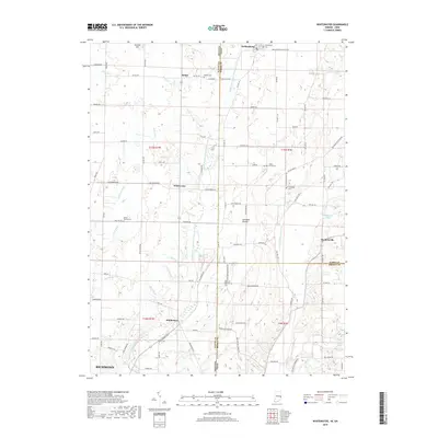
2019 Map of Whitewater
USGS Topo · Published 2019About this map
Hoosier Hill and the surrounding farmland dominate this border region where Indiana meets Ohio. The landscape is defined by the complex drainage systems of the Middle Fork East Fork Whitewater River and the E Fork Whitewater River, which carve through the till plains. Small rural clusters like Bethel, Whitewater, and Middleboro serve as historic anchors for the agricultural community. Genealogists will find several burial sites preserved across the countryside, including Bethel Cem, Hollansburg Cem, and the Pleasant Hill Cem near the state line. The northern reaches show the open expanse of Sunbeam Prairie, while the southern edge touches the outskirts of Richmond, indicating the transition from quiet township life to the growing urban influence of Wayne County. Numerous small tributaries such as Clay Run and Ross Ditch highlight the local water management essential to the area's farming history.
Find a feature on this map
101 named features on this map. Tap any name to fly to it.
Don’t see what you’re looking for? This feature index may not catch every label — zoom into the map to look around manually.
Map Details
Editions of this 2019 Whitewater Map
This is the sole edition of this map. No revisions or reprints were ever made.
Other maps of this area

1915 · New Paris
USGS Topo · 1:48,000

1916 · Winchester
USGS Topo · 1:48,000

1918 · Winchester
USGS Topo · 1:62,500

1918 · New Paris
USGS Topo · 1:62,500

1943 · Winchester
USGS Topo · 1:62,500

1953 · Cincinnati
USGS Topo · 1:250,000

1953 · Muncie
USGS Topo · 1:250,000

1956 · Muncie
USGS Topo · 1:250,000

1957 · Cincinnati
USGS Topo · 1:250,000

1960 · New Madison
USGS Topo · 1:24,000