
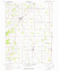
1960 Map of New Madison
USGS Topo · Published 1961About this map
New Madison serves as the central hub of this 1960 landscape, where the Pennsylvania and New York Central railroads intersect amidst a productive agricultural district. The terrain is defined by an extensive network of drainage infrastructure, including the Thompson Joint County Ditch and Lateral Ditch, which support the farms of Harrison and Butler townships. Small rural hamlets like Hollansburg, Eldorado, and Castine are connected by a grid of family-named roads such as John W Mills Rd and Paul and Mc Kee Road.
Find a feature on this map
68 named features on this map. Tap any name to fly to it.
Don’t see what you’re looking for? This feature index may not catch every label — zoom into the map to look around manually.
Map Details
Editions of this 1960 New Madison Map
Other maps of this area

1915 · New Paris
USGS Topo · 1:48,000

1916 · Winchester
USGS Topo · 1:48,000

1918 · Winchester
USGS Topo · 1:62,500

1918 · New Paris
USGS Topo · 1:62,500

1943 · Winchester
USGS Topo · 1:62,500

1953 · Cincinnati
USGS Topo · 1:250,000

1953 · Muncie
USGS Topo · 1:250,000

1956 · Muncie
USGS Topo · 1:250,000

1957 · Cincinnati
USGS Topo · 1:250,000
1960 · Spartanburg
USGS Topo · 1:24,000