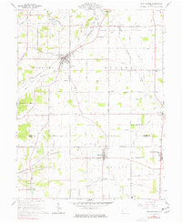
1960 Map of New Madison
USGS Topo · Published 1977About this map
New Madison and Eldorado anchor this agricultural landscape along the Darke Co Preble Co line, where the local economy revolves around a network of township roads and rail lines. The Pennsylvania RR and NYC RR cut diagonally across the terrain, serving clusters of smaller settlements like Savona, Castine, and West Manchester. The landscape is dotted with small family and community burial grounds, including Greenmound Cem and Yankeetown Cem, which provide significant points of interest for genealogical research in this part of western Ohio.
Find a feature on this map
74 named features on this map. Tap any name to fly to it.
Don’t see what you’re looking for? This feature index may not catch every label — zoom into the map to look around manually.
Map Details
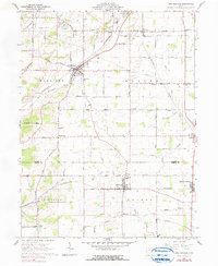
Editions of this 1960 New Madison Map
Other maps of this area

1915 · New Paris
USGS Topo · 1:48,000

1916 · Winchester
USGS Topo · 1:48,000

1918 · Winchester
USGS Topo · 1:62,500

1918 · New Paris
USGS Topo · 1:62,500

1943 · Winchester
USGS Topo · 1:62,500

1953 · Cincinnati
USGS Topo · 1:250,000

1953 · Muncie
USGS Topo · 1:250,000

1956 · Muncie
USGS Topo · 1:250,000

1957 · Cincinnati
USGS Topo · 1:250,000

1960 · New Madison
USGS Topo · 1:24,000