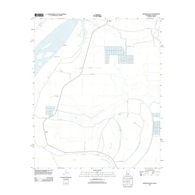
2012 Map of Whiting Bayou
USGS Topo · Published 2012About this map
The Mississippi River forms the western boundary of this Mississippi Delta landscape, defining a series of oxbows and river-side settlements such as Holly Ridge Landing and Baleshed Landing. The land here is marked by its relationship to water and agriculture, with complex drainage networks feeding into Steele Bayou and isolated bodies like Carlisle Lake, Bear Lake, and Goose Lake. The interior is crisscrossed by rural routes including Ben Lamand Rd and Windham Rd, which service the scattered communities of Tallula and Elleslie. This 2012 survey illustrates the modern topography of a classic alluvial floodplain, where large agricultural tracts are bisected by historic bayous and the remaining evidence of old river landings that once served as vital links to the world beyond the levees.
Find a feature on this map
27 named features on this map. Tap any name to fly to it.
Don’t see what you’re looking for? This feature index may not catch every label — zoom into the map to look around manually.
Map Details
Editions of this 2012 Whiting Bayou Map
This is the sole edition of this map. No revisions or reprints were ever made.
Other maps of this area

1909 · Lake Providence
USGS Topo · 1:24,000

1909 · Wilsons Point
USGS Topo · 1:24,000

1909 · Millikin
USGS Topo · 1:24,000

1911 · Lake Providence
USGS Topo · 1:31,680

1913 · Wilson Point
USGS Topo · 1:31,680

1939 · Onward
USGS Topo · 1:62,500

1939 · Lorenzen
USGS Topo · 1:62,500

1939 · Alsatia
USGS Topo · 1:62,500

1939 · Mayersville
USGS Topo · 1:62,500

1955 · Jackson
USGS Topo · 1:250,000