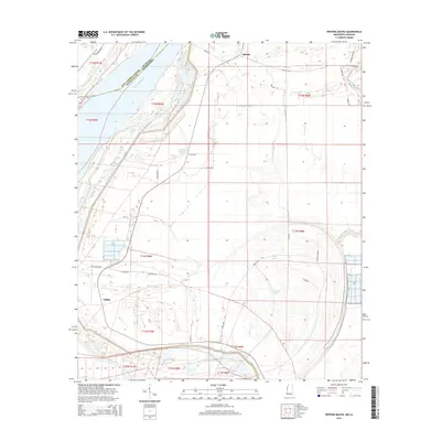
2015 Map of Whiting Bayou
USGS Topo · Published 2015About this map
The Mississippi River defines the western edge of this landscape, marking the state boundary between Louisiana and Mississippi. This alluvial environment is characterized by dramatic oxbow remnants and secondary waterways like Whiting Bayou and Steele Bayou, which snake through the flatlands of East Carroll Parish and Issaquena County. The map provides a detailed view of the rural road network and settlement patterns in the mid-2010s, centered on the communities of Elleslie and Tallula.
Find a feature on this map
36 named features on this map. Tap any name to fly to it.
Don’t see what you’re looking for? This feature index may not catch every label — zoom into the map to look around manually.
Map Details
Editions of this 2015 Whiting Bayou Map
This is the sole edition of this map. No revisions or reprints were ever made.
Other maps of this area

1909 · Lake Providence
USGS Topo · 1:24,000

1909 · Wilsons Point
USGS Topo · 1:24,000

1909 · Millikin
USGS Topo · 1:24,000

1911 · Lake Providence
USGS Topo · 1:31,680

1913 · Wilson Point
USGS Topo · 1:31,680

1939 · Onward
USGS Topo · 1:62,500

1939 · Lorenzen
USGS Topo · 1:62,500

1939 · Alsatia
USGS Topo · 1:62,500

1939 · Mayersville
USGS Topo · 1:62,500

1955 · Jackson
USGS Topo · 1:250,000