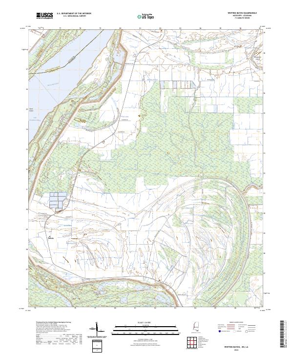
2024 Map of Whiting Bayou
USGS Topo · Published 2024About this map
The Mississippi River carves a massive loop along the border of Louisiana and Mississippi, defining the shifting geography of this riverfront region. This landscape is shaped by the constant movement of water, where old channels and oxbows have created features like Lake Providence Reach and the quiet waters of Carlisle Lake. The settlement of Tallula sits protected behind a complex system of embankments, including the prominent Levee Rd, which traces the river's path to manage the seasonal flooding inherent to the Delta.
Find a feature on this map
41 named features on this map. Tap any name to fly to it.
Don’t see what you’re looking for? This feature index may not catch every label — zoom into the map to look around manually.
Map Details
Editions of this 2024 Whiting Bayou Map
This is the sole edition of this map. No revisions or reprints were ever made.
Other maps of this area

1909 · Lake Providence
USGS Topo · 1:24,000

1909 · Wilsons Point
USGS Topo · 1:24,000

1909 · Millikin
USGS Topo · 1:24,000

1911 · Lake Providence
USGS Topo · 1:31,680

1913 · Wilson Point
USGS Topo · 1:31,680

1939 · Onward
USGS Topo · 1:62,500

1939 · Lorenzen
USGS Topo · 1:62,500

1939 · Alsatia
USGS Topo · 1:62,500

1939 · Mayersville
USGS Topo · 1:62,500

1955 · Jackson
USGS Topo · 1:250,000