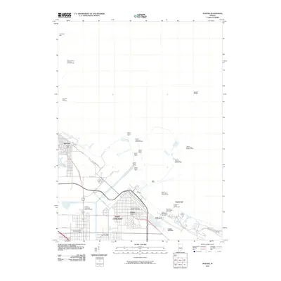
2010 Map of Whiting
USGS Topo · Published 2010About this map
Indiana Harbor serves as a central industrial and navigational hub on this Lake Michigan shoreline, where the Indiana Harbor Canal and Lake George Canal cut through the urban landscape of East Chicago and Whiting. The shoreline is heavily modified with breakwaters and specialized maritime infrastructure, including an extensive system of navigational aids such as the Indiana Harbor Light 2 and the Buffington Harbor Breakwater Light. The map reveals a dense corridor of transportation and heavy industry, interspersed with institutional landmarks like the Indiana University Calumet Center. To the east, the settlement of Buffington and the rail-oriented Clarke Junction mark the edge of this industrial complex. Offshore, features like Calumet Bar and Indiana Shoals indicate the natural lake-bottom topography that dictated the placement of harbor defenses and the Hammond Intake Crib Light.
Find a feature on this map
39 named features on this map. Tap any name to fly to it.
Don’t see what you’re looking for? This feature index may not catch every label — zoom into the map to look around manually.
Map Details
Editions of this 2010 Whiting Map
This is the sole edition of this map. No revisions or reprints were ever made.
Other maps of this area

1889 · Chicago
USGS Topo · 1:62,500

1891 · Chicago
USGS Topo · 1:62,500

1892 · Calumet
USGS Topo · 1:62,500

1893 · Calumet
USGS Topo · 1:62,500

1900 · Chicago
USGS Topo · 1:62,500

1900 · Toleston
USGS Topo · 1:62,500

1900 · Calumet
USGS Topo · 1:62,500

1901 · Calumet
USGS Topo · 1:62,500

1901 · Chicago
USGS Topo · 1:62,500

1929 · Calumet Lake
USGS Topo · 1:24,000