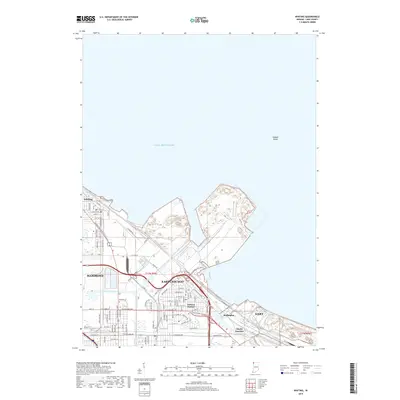
2019 Map of Whiting
USGS Topo · Published 2019About this map
Inland Steel Co and its massive industrial footprint dominate this Lake County shoreline, where the massive works meet the deep waters of Lake Michigan. This 2019 survey captures the intricate infrastructure of the Calumet Region, showing the dense urban grids of Whiting and East Chicago alongside the complex waterways of the Indiana Harbor Canal and Lake George Canal. These artificial channels facilitate the movement of goods between the lakeshore and inland rail junctions like Clarke Junction. The map details the transition from the residential streets of Hammond and Gary to the heavy industrial zones of Buffington. Further offshore, the Indiana Shoals represent the submerged topography of the lake, while on land, the Whihala Beach Trail provides a rare recreational corridor amidst the manufacturing and logistics hubs of the harbor.
Find a feature on this map
87 named features on this map. Tap any name to fly to it.
Don’t see what you’re looking for? This feature index may not catch every label — zoom into the map to look around manually.
Map Details
Editions of this 2019 Whiting Map
This is the sole edition of this map. No revisions or reprints were ever made.
Other maps of this area

1889 · Chicago
USGS Topo · 1:62,500

1891 · Chicago
USGS Topo · 1:62,500

1892 · Calumet
USGS Topo · 1:62,500

1893 · Calumet
USGS Topo · 1:62,500

1900 · Chicago
USGS Topo · 1:62,500

1900 · Toleston
USGS Topo · 1:62,500

1900 · Calumet
USGS Topo · 1:62,500

1901 · Calumet
USGS Topo · 1:62,500

1901 · Chicago
USGS Topo · 1:62,500

1929 · Calumet Lake
USGS Topo · 1:24,000