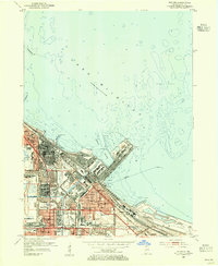
1953 Map of Whiting
USGS Topo · Published 1955About this map
Industrial infrastructure and heavy rail networks dominate this early 1950s survey of the Lake Michigan shoreline. Huge industrial footprints, including a massive Oil Refinery and the sprawling Slag Dump near Gary, define the landscape. The intricate Indiana Harbor complex, supported by a network of Intake Cribs and aqueducts, serves as a focal point for the regional economy. Beyond the factories, the map captures the dense social fabric of Whiting and East Chicago, where numerous neighborhood schools like Roosevelt Sch and Washington High Sch sit adjacent to major rail arteries.
Find a feature on this map
53 named features on this map. Tap any name to fly to it.
Don’t see what you’re looking for? This feature index may not catch every label — zoom into the map to look around manually.
Map Details
Editions of this 1953 Whiting Map
This is the sole edition of this map. No revisions or reprints were ever made.
Other maps of this area

1889 · Chicago
USGS Topo · 1:62,500

1891 · Chicago
USGS Topo · 1:62,500

1892 · Calumet
USGS Topo · 1:62,500

1893 · Calumet
USGS Topo · 1:62,500

1900 · Chicago
USGS Topo · 1:62,500

1900 · Toleston
USGS Topo · 1:62,500

1900 · Calumet
USGS Topo · 1:62,500

1901 · Calumet
USGS Topo · 1:62,500

1901 · Chicago
USGS Topo · 1:62,500

1929 · Calumet Lake
USGS Topo · 1:24,000