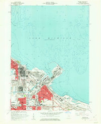
1960 Map of Whiting
USGS Topo · Published 1962About this map
Industrial infrastructure along the southern tip of Lake Michigan dominates this early 1960s landscape, where the heavy industry of Whiting and East Chicago meets the water. Large clusters of oil reservoirs and refineries sit adjacent to the intricate residential grids of the city, including the planned community of Mark Town with its central Mark Town Park. The coastline is heavily modified by man-made piers and slips, most notably at Indiana Harbor and Buffington Harbor, facilitating the movement of materials for the regional economy.
Find a feature on this map
46 named features on this map. Tap any name to fly to it.
Don’t see what you’re looking for? This feature index may not catch every label — zoom into the map to look around manually.
Map Details
Editions of this 1960 Whiting Map
This is the sole edition of this map. No revisions or reprints were ever made.
Other maps of this area

1889 · Chicago
USGS Topo · 1:62,500

1891 · Chicago
USGS Topo · 1:62,500

1892 · Calumet
USGS Topo · 1:62,500

1893 · Calumet
USGS Topo · 1:62,500

1900 · Chicago
USGS Topo · 1:62,500

1900 · Toleston
USGS Topo · 1:62,500

1900 · Calumet
USGS Topo · 1:62,500

1901 · Calumet
USGS Topo · 1:62,500

1901 · Chicago
USGS Topo · 1:62,500

1929 · Calumet Lake
USGS Topo · 1:24,000