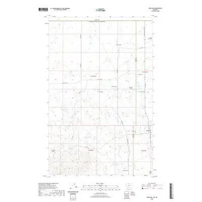
2020 Map of Whitlash
USGS Topo · Published 2020About this map
Whitlash serves as a remote hub in Liberty County near the Sweet Grass Hills, characterized by its location just south of the border between Canada and the United States. This landscape is defined by its series of seasonal drainages and coulees, including Kent, Spring, and Simmons Coulee, which pattern the high plains. The settlement itself is anchored by a local post office and the Whitlash Cemetery, indicating a long-standing community footprint in this northern ranching region. Water management is a central feature of the terrain, with several named impoundments such as Cook Reservoir, Brown Reservoir, and Morris Reservoir providing vital resources for agriculture. Transport in the area relies on a network of named county roads like Gardner Road and Miners Coulee Road, which connect isolated homesteads and grazing lands across the Toole and Liberty County line.
Find a feature on this map
36 named features on this map. Tap any name to fly to it.
Don’t see what you’re looking for? This feature index may not catch every label — zoom into the map to look around manually.
Map Details
Editions of this 2020 Whitlash Map
This is the sole edition of this map. No revisions or reprints were ever made.
Other maps of this area

1954 · Shelby
USGS Topo · 1:250,000

1958 · Shelby
USGS Topo · 1:250,000

1962 · Whitlash
USGS Topo · 1:24,000

1962 · Cameron Lake
USGS Topo · 1:24,000

1962 · Fey Lakes
USGS Topo · 1:24,000
1962 · Hawley Hill
USGS Topo · 1:24,000

1962 · Haystack Butte
USGS Topo · 1:24,000

1962 · Grassy Butte
USGS Topo · 1:24,000

1984 · Sweet Grass Hills
USGS Topo · 1:100,000
2011 · Fey Lakes
USGS Topo · 1:24,000