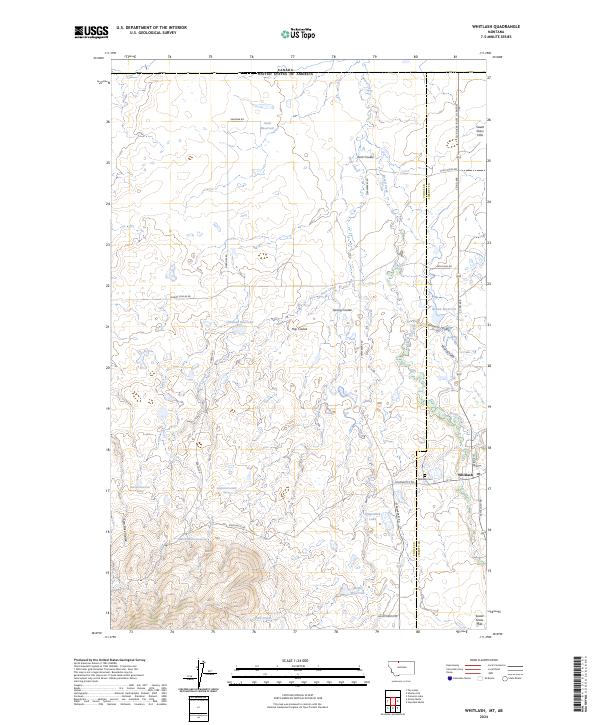
2024 Map of Whitlash
USGS Topo · Published 2024About this map
The settlement of Whitlash sits at the eastern edge of this landscape, just south of the international boundary between Canada and the United States. Located in the northern reach of the Sweet Grass Hills, the area is characterized by a network of drainage coulees including Kent Coulee, Miners Coulee, and Sam Ross Coulee. These features emphasize the reliance on managed water in the High Plains, evidenced by the numerous catchment points such as Cook Reservoir, Christian Reservoir, and Fitzpatrick Lake.
Find a feature on this map
39 named features on this map. Tap any name to fly to it.
Don’t see what you’re looking for? This feature index may not catch every label — zoom into the map to look around manually.
Map Details
Editions of this 2024 Whitlash Map
This is the sole edition of this map. No revisions or reprints were ever made.
Other maps of this area

1954 · Shelby
USGS Topo · 1:250,000

1958 · Shelby
USGS Topo · 1:250,000

1962 · Whitlash
USGS Topo · 1:24,000

1962 · Cameron Lake
USGS Topo · 1:24,000

1962 · Fey Lakes
USGS Topo · 1:24,000
1962 · Hawley Hill
USGS Topo · 1:24,000

1962 · Haystack Butte
USGS Topo · 1:24,000

1962 · Grassy Butte
USGS Topo · 1:24,000

1984 · Sweet Grass Hills
USGS Topo · 1:100,000
2011 · Fey Lakes
USGS Topo · 1:24,000