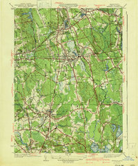
1941 Map of Whitman
USGS Topo · Published 1941About this map
Whitman and Abington anchor this industrial and agricultural landscape of Plymouth County just before the mid-century. The New York New Haven and Hartford railroad creates a central corridor through towns like South Hanson and East Bridgewater, connecting the region's manufacturing centers. In the northeast, the Fireworks facility and Factory Pond indicate the area's specialized industrial heritage, while extensive Cranberry Bogs near Burrage Pond and Robbins Pond show the continued importance of traditional wetland agriculture.
Find a feature on this map
120 named features on this map. Tap any name to fly to it.
Don’t see what you’re looking for? This feature index may not catch every label — zoom into the map to look around manually.
Map Details
Editions of this 1941 Whitman Map
3 editions found
Other maps of this area

1885 · Abington
USGS Topo · 1:62,500

1885 · Middleboro
USGS Topo · 1:62,500

1885 · Taunton
USGS Topo · 1:62,500

1886 · Dedham
USGS Topo · 1:62,500

1888 · Taunton
USGS Topo · 1:62,500

1888 · Middleboro
USGS Topo · 1:62,500

1888 · Abington
USGS Topo · 1:62,500

1893 · Abington
USGS Topo · 1:62,500

1893 · Taunton
USGS Topo · 1:62,500

1893 · Middleboro
USGS Topo · 1:62,500