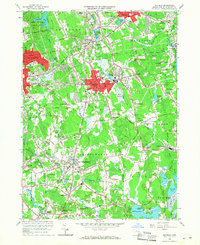
1962 Map of Whitman
USGS Topo · Published 1968About this map
Whitman and Abington anchor this mid-century survey of Plymouth County, where the industrial corridors of the New York New Haven and Hartford railroad define the local geography. The landscape is a distinct mix of established residential centers and traditional agricultural features, notably the numerous Cranberry Bogs and Sand and Gravel Pits that punctuate the area between East Bridgewater and Hanson. Educational and civic life is centered around landmarks like the Whitman-Hanson Regional High Sch and the Spellman Central High Sch.
Find a feature on this map
116 named features on this map. Tap any name to fly to it.
Don’t see what you’re looking for? This feature index may not catch every label — zoom into the map to look around manually.
Map Details
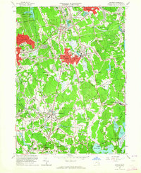
Editions of this 1962 Whitman Map
2 editions found
Other maps of this area

1885 · Abington
USGS Topo · 1:62,500

1885 · Middleboro
USGS Topo · 1:62,500

1885 · Taunton
USGS Topo · 1:62,500

1886 · Dedham
USGS Topo · 1:62,500

1888 · Taunton
USGS Topo · 1:62,500

1888 · Middleboro
USGS Topo · 1:62,500

1888 · Abington
USGS Topo · 1:62,500

1893 · Abington
USGS Topo · 1:62,500

1893 · Taunton
USGS Topo · 1:62,500

1893 · Middleboro
USGS Topo · 1:62,500