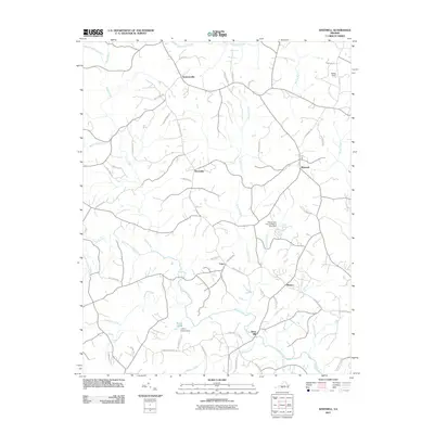
2011 Map of Whitmell
USGS Topo · Published 2011About this map
Stony Mill and its neighboring crossroads communities define the landscape of south-central Pittsylvania County in this early twenty-first-century survey. The area is characterized by a dense network of country roads, such as Stony Mill School Rd and Collins Farm Rd, connecting long-standing rural settlements including Swansonville, Whitmell, and Hinesville. The drainage pattern is dominated by the Sandy River and its numerous tributaries, including Hardys Creek and the South Prong Sandy River, which wind through the terrain. Evidence of local recreation and land management appears in features like the Pittsylvania County Riding Club Dam and the Layton Bacon Dam creating Bacon Pond. This map documents a traditional Virginia piedmont landscape where family names remain firmly attached to the geography, from the Oakes Dam in the northeast to the small community of Sharon near Silver Creek.
Find a feature on this map
55 named features on this map. Tap any name to fly to it.
Don’t see what you’re looking for? This feature index may not catch every label — zoom into the map to look around manually.
Map Details
Editions of this 2011 Whitmell Map
This is the sole edition of this map. No revisions or reprints were ever made.
Other maps of this area

1921 · Chatham
USGS Topo · 1:48,000

1922 · Callands
USGS Topo · 1:48,000

1923 · Danville
USGS Topo · 1:48,000

1923 · Chatham
USGS Topo · 1:62,500

1924 · Draper
USGS Topo · 1:48,000

1924 · Callands
USGS Topo · 1:62,500

1925 · Danville
USGS Topo · 1:62,500

1926 · Draper
USGS Topo · 1:62,500

1944 · Draper
USGS Topo · 1:62,500

1944 · Callands
USGS Topo · 1:62,500