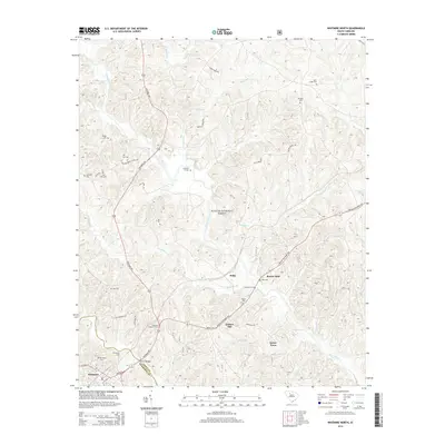
2014 Map of Whitmire North
USGS Topo · Published 2014About this map
The Tyger River and Enoree River systems define the landscape of this region, which is heavily shaped by the expansive Sumter National Forest. This 2014 survey documents the enduring rural structure of the South Carolina Piedmont, where the Union and Newberry county lines meet at the town of Whitmire. The area is characterized by scattered family-named cemeteries and crossroads, such as Goshen Hill and Sartor Town, reflecting long-standing land ownership patterns. Notable river crossings like Hamiltons Ford and Kennedys Ford alongside the Thorp Bridge illustrate how local travel has historically navigated the numerous creeks, including Fairforest Creek and Padgetts Cr. For the genealogist or local historian, the map preserves the locations of numerous burial sites, from Otterson Ft Cem to Gilliams Cem, and local landmarks like the Whitmire Lookout Tower.
Find a feature on this map
55 named features on this map. Tap any name to fly to it.
Don’t see what you’re looking for? This feature index may not catch every label — zoom into the map to look around manually.
Map Details
Editions of this 2014 Whitmire North Map
This is the sole edition of this map. No revisions or reprints were ever made.
Other maps of this area

1904 · Columbia
USGS Topo · 1:125,000

1941 · Spartanburg
USGS Topo · 1:250,000

1953 · Spartanburg
USGS Topo · 1:250,000

1960 · Spartanburg
USGS Topo · 1:250,000

1963 · Spartanburg
USGS Topo · 1:250,000

1964 · Spartanburg
USGS Topo · 1:250,000

1969 · Whitmire South
USGS Topo · 1:24,000

1969 · Blair
USGS Topo · 1:24,000

1969 · Newberry NW
USGS Topo · 1:24,000

1969 · Union West
USGS Topo · 1:24,000