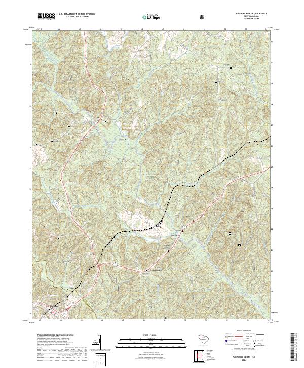
2024 Map of Whitmire North
USGS Topo · Published 2024About this map
Sumter National Forest dominates this landscape in South Carolina, where the Tyger River and Enoree River carve through the woodland of Union and Newberry counties. The map preserves the names of small communities such as Delta and Goshen Hill, alongside numerous historical family burial grounds including Briggs Cem, Fant Cem, and the McDaniel Cem. The area’s spiritual and communal history is anchored by the Cane Creek Quaker Church Graveyard and dual sites for Rogers Church. A network of rural routes like Beattys Bridge Rd and Old US Hwy 176 connects these settlements to the town of Whitmire at the southern edge. The river system features unique landmarks like Rogers Ferry and Hawkins Shoals, reflecting a time when these waterways were central to local movement and commerce.
Find a feature on this map
57 named features on this map. Tap any name to fly to it.
Don’t see what you’re looking for? This feature index may not catch every label — zoom into the map to look around manually.
Map Details
Editions of this 2024 Whitmire North Map
This is the sole edition of this map. No revisions or reprints were ever made.
Other maps of this area

1904 · Columbia
USGS Topo · 1:125,000

1941 · Spartanburg
USGS Topo · 1:250,000

1953 · Spartanburg
USGS Topo · 1:250,000

1960 · Spartanburg
USGS Topo · 1:250,000

1963 · Spartanburg
USGS Topo · 1:250,000

1964 · Spartanburg
USGS Topo · 1:250,000

1969 · Whitmire South
USGS Topo · 1:24,000

1969 · Blair
USGS Topo · 1:24,000

1969 · Newberry NW
USGS Topo · 1:24,000

1969 · Union West
USGS Topo · 1:24,000