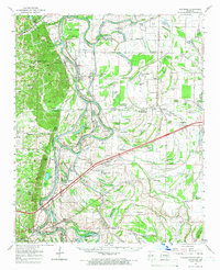
1960 Map of Whitmore
USGS Topo · Published 1966About this map
Wittsburg Island and the meandering loops of Johnson Bend dominate this mid-century view of the Arkansas delta, where the St Francis River defines the landscape. The river's complex oxbows and islands, including Mussel Bay and Big Bear Lake, highlight a terrain shaped by water and the floodway systems managed by the Mississippi River Commission. The map documents a dense network of rural life, particularly evident in the concentration of small churches like New Bethel Ch, Antioch Ch, and Newcastle Ch that anchored these farming communities.
Find a feature on this map
133 named features on this map. Tap any name to fly to it.
Don’t see what you’re looking for? This feature index may not catch every label — zoom into the map to look around manually.
Map Details
Editions of this 1960 Whitmore Map
This is the sole edition of this map. No revisions or reprints were ever made.
Other maps of this area

1931 · Horseshoe Lake
USGS Topo · 1:62,500

1939 · Vanndale
USGS Topo · 1:62,500

1939 · Horseshoe Lake
USGS Topo · 1:62,500

1939 · Park Place
USGS Topo · 1:62,500

1939 · Wynne
USGS Topo · 1:62,500

1939 · Edmondson
USGS Topo · 1:62,500

1940 · Deckerville
USGS Topo · 1:62,500

1940 · Princedale
USGS Topo · 1:62,500

1940 · Whitmore
USGS Topo · 1:62,500

1940 · Marianna
USGS Topo · 1:62,500