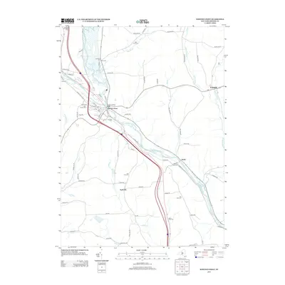
2013 Map of Whitney Point
USGS Topo · Published 2013About this map
The confluence of the Otselic River and the Tioughnioga River shapes the development of Broome County, where the settlement of Whitney Point serves as a central hub. The landscape is defined by the convergence of these major waterways and the infrastructure supporting them, including the Tioughnioga River Bridge. Further east, the village of Triangle sits along Halfway Brook, illustrating a late twentieth-century pattern of dispersed rural hamlets connected by winding valley roads like Page Brook Rd.
Find a feature on this map
81 named features on this map. Tap any name to fly to it.
Don’t see what you’re looking for? This feature index may not catch every label — zoom into the map to look around manually.
Map Details
Editions of this 2013 Whitney Point Map
This is the sole edition of this map. No revisions or reprints were ever made.
Other maps of this area

1901 · Apalachin
USGS Topo · 1:62,500

1903 · Harford
USGS Topo · 1:62,500

1904 · Binghamton
USGS Topo · 1:62,500

1904 · Greene
USGS Topo · 1:62,500

1904 · Apalachin
USGS Topo · 1:62,500

1906 · Catatonk
USGS Topo · 1:125,000

1934 · Castle Creek
USGS Topo · 1:24,000

1935 · Chenango Forks
USGS Topo · 1:24,000

1942 · Castle Creek
USGS Topo · 1:31,680

1942 · Chenango Forks
USGS Topo · 1:31,680