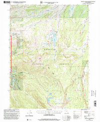
1998 Map of Whitney Reservoir
USGS Topo · Published 2001About this map
High mountain hydrology and Forest Service administration define this late-20th-century landscape within the Wasatch National Forest. Centered on the Whitney Reservoir, the map traces the headwaters of the West Fork Bear River and the Hayden Fork, revealing a complex network of glacial lakes including Whiskey Island Lake, Sand Lake, and the well-known Mirror Lake at the southern boundary. The presence of the Whitney Guard Sta and a Gaging Station near the reservoir indicates active water management and forest oversight during this era.
Find a feature on this map
34 named features on this map. Tap any name to fly to it.
Don’t see what you’re looking for? This feature index may not catch every label — zoom into the map to look around manually.
Map Details
Editions of this 1998 Whitney Reservoir Map
This is the sole edition of this map. No revisions or reprints were ever made.
Other maps of this area

1885 · Salt Lake
USGS Topo · 1:250,000

1885 · Uinta
USGS Topo · 1:250,000

1900 · Coalville
USGS Topo · 1:125,000

1901 · Hayden Peak
USGS Topo · 1:125,000

1903 · Hayden Peak
USGS Topo · 1:125,000

1903 · Coalville
USGS Topo · 1:125,000

1954 · Salt Lake City
USGS Topo · 1:250,000

1958 · Salt Lake City
USGS Topo · 1:250,000

1960 · Salt Lake City
USGS Topo · 1:250,000
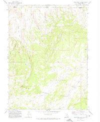
1972 · Seven Tree Flat
USGS Topo · 1:24,000