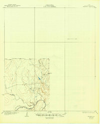
1930 Map of Whitsett
USGS Topo · Published 1949About this map
The Frio River winds through the southern portion of this landscape, serving as a primary drainage point for the surrounding McMullen County terrain. Near the center of the surveyed portion, the settlement of Crowther sits as a primary point of human activity, situated north of the prominent Opossum Hill. The map reflects a period where significant portions of the Texas brush country remained an Unsurveyed Area, leaving a stark boundary between the documented topography and the unknown territory to the east. Several intermittent waterways, including San Miguel Creek, Elm Creek, and Opossum Creek, feed into the river system, illustrating the natural watershed patterns of the region before modern diversions. This 1925 topography, partially compiled from early Army Air Corps aerial photography, provides a rare look at the original placement of local landmarks like Frenchman Br in an era of sparse development.
Find a feature on this map
8 named features on this map. Tap any name to fly to it.
Don’t see what you’re looking for? This feature index may not catch every label — zoom into the map to look around manually.
Map Details
Editions of this 1930 Whitsett Map
2 editions found
Other maps of this area

1920 · Mikeska
USGS Topo · 1:125,000

1925 · Simmons No. 1
USGS Topo · 1:48,000

1925 · Tilden No. 1
USGS Topo · 1:48,000

1925 · Crowther No. 3
USGS Topo · 1:48,000

1925 · Simmons No. 2
USGS Topo · 1:48,000

1927 · Oakville
USGS Topo · 1:62,500

1929 · Simmons
USGS Topo · 1:62,500

1930 · Tilden
USGS Topo · 1:62,500

1930 · Whitsett
USGS Topo · 1:62,500

1931 · Falls City
USGS Topo · 1:62,500