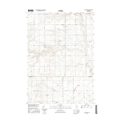
2017 Map of Whittemore
USGS Topo · Published 2017About this map
Whittemore and Turner serve as the primary hubs in this agricultural and woodland landscape along the boundary of Iosco and Arenac Counties. The terrain is defined by an intricate network of drainage and creek systems, including Porterfield Cr, Mongo Cr, and the winding Au Gres River in the east. These waterways are supplemented by engineered water management features such as the Johnson Cr Drain and Scott Drain, which reflect the region's history of land reclamation for farming.
Find a feature on this map
81 named features on this map. Tap any name to fly to it.
Don’t see what you’re looking for? This feature index may not catch every label — zoom into the map to look around manually.
Map Details
Editions of this 2017 Whittemore Map
This is the sole edition of this map. No revisions or reprints were ever made.
Other maps of this area

1954 · Tawas City
USGS Topo · 1:250,000

1958 · Tawas City
USGS Topo · 1:250,000

1959 · Tawas City
USGS Topo · 1:62,500

1966 · Au Gres
USGS Topo · 1:24,000

1966 · National City
USGS Topo · 1:24,000

1968 · Prescott
USGS Topo · 1:24,000

1968 · Whittemore
USGS Topo · 1:24,000

1968 · Sage Lake
USGS Topo · 1:24,000
1968 · Omer SW
USGS Topo · 1:24,000
1968 · Omer
USGS Topo · 1:24,000