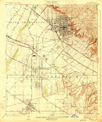
1925 Map of Whittier
USGS Topo · Published 1925About this map
The San Gabriel River flows through a landscape defined by rapid industrialization and agricultural roots in the mid-1920s. A dense cluster of Oil Wells dominates the area around Santa Fe Springs, illustrating the region's petroleum boom that transformed the former Rancho Santa Gertrudes. This economic activity is supported by a sophisticated network of transportation, including the Pacific Electric and Atchison Topeka and Santa Fe railroads, which linked these inland settlements to the growing Los Angeles metropolitan core.
Find a feature on this map
57 named features on this map. Tap any name to fly to it.
Don’t see what you’re looking for? This feature index may not catch every label — zoom into the map to look around manually.
Map Details
Editions of this 1925 Whittier Map
2 editions found
Other maps of this area

1894 · Los Angeles
USGS Topo · 1:62,500

1894 · Pomona
USGS Topo · 1:62,500

1896 · Pasadena
USGS Topo · 1:62,500

1896 · Anaheim
USGS Topo · 1:62,500

1896 · Downey
USGS Topo · 1:62,500

1897 · Pomona
USGS Topo · 1:62,500

1898 · Pomona
USGS Topo · 1:62,500

1898 · Anaheim
USGS Topo · 1:62,500

1899 · Downey
USGS Topo · 1:62,500

1900 · Pasadena
USGS Topo · 1:62,500