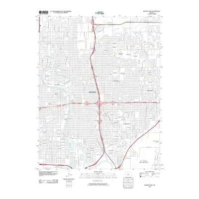
2010 Map of Wichita East
USGS Topo · Published 2010About this map
Wichita serves as the focal point for this urban landscape, where the Arkansas River and Little Arkansas River converge near the historic Cow Town area. The 2010 map highlights a dense network of residential streets and civic institutions, including the sprawling campus of Wichita State University and Friends University further west. Major transportation arteries like E Kellogg St and S Turnpike Dr cut through the city, connecting residential districts to industrial and military hubs.
Find a feature on this map
42 named features on this map. Tap any name to fly to it.
Don’t see what you’re looking for? This feature index may not catch every label — zoom into the map to look around manually.
Map Details
Editions of this 2010 Wichita East Map
This is the sole edition of this map. No revisions or reprints were ever made.
Other maps of this area

1889 · Wichita
USGS Topo · 1:125,000

1894 · Wichita
USGS Topo · 1:125,000

1941 · Maize
USGS Topo · 1:31,680

1941 · Valley Center
USGS Topo · 1:31,680

1942 · Valley Center
USGS Topo · 1:31,680

1942 · Maize
USGS Topo · 1:31,680

1943 · Wichita West
USGS Topo · 1:31,680

1943 · Wichita East
USGS Topo · 1:31,680

1943 · Derby
USGS Topo · 1:31,680

1943 · Bayneville
USGS Topo · 1:31,680