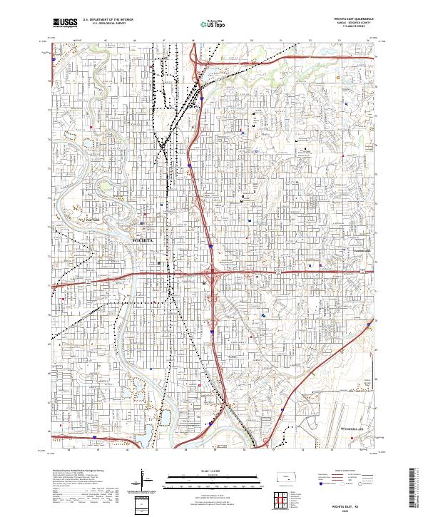
2022 Map of Wichita East
USGS Topo · Published 2022About this map
The Arkansas River and Little Arkansas River converge near the heart of Wichita, anchoring a landscape that bridges the city's frontier beginnings and its modern academic and civic infrastructure. The presence of Cow Town near the river bend serves as a direct reference to the area's pioneer heritage, while the Sedgwick County Courthouse marks the administrative core. This survey illustrates the dense residential and institutional development of eastern Sedgwick County, featuring prominent campuses such as Wichita State University and Friends University.
Find a feature on this map
36 named features on this map. Tap any name to fly to it.
Don’t see what you’re looking for? This feature index may not catch every label — zoom into the map to look around manually.
Map Details
Editions of this 2022 Wichita East Map
This is the sole edition of this map. No revisions or reprints were ever made.
Other maps of this area

1889 · Wichita
USGS Topo · 1:125,000

1894 · Wichita
USGS Topo · 1:125,000

1941 · Maize
USGS Topo · 1:31,680

1941 · Valley Center
USGS Topo · 1:31,680

1942 · Valley Center
USGS Topo · 1:31,680

1942 · Maize
USGS Topo · 1:31,680

1943 · Wichita West
USGS Topo · 1:31,680

1943 · Wichita East
USGS Topo · 1:31,680

1943 · Derby
USGS Topo · 1:31,680

1943 · Bayneville
USGS Topo · 1:31,680