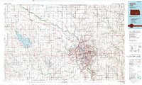
1990 Map of Wichita
USGS Topo · Published 1990About this map
The Arkansas River and its confluence with the Little Arkansas River define the core of Wichita in this 1990 survey. The city's late-twentieth-century sprawl is bounded by major transit hubs and military installations, most notably McConnell Air Force Base on the southeast and Wichita Mid-Continent Airport to the west. The landscape reflects a transition from high-density urban development to a wide-ranging network of satellite towns like Haysville, Derby, and Maize.
Find a feature on this map
126 named features on this map. Tap any name to fly to it.
Don’t see what you’re looking for? This feature index may not catch every label — zoom into the map to look around manually.
Map Details
Editions of this 1990 Wichita Map
This is the sole edition of this map. No revisions or reprints were ever made.
Other maps of this area

1888 · Eldorado
USGS Topo · 1:125,000

1889 · Newton
USGS Topo · 1:125,000

1889 · Burden
USGS Topo · 1:125,000

1889 · Anthony
USGS Topo · 1:125,000

1889 · Cheney
USGS Topo · 1:125,000

1889 · Wichita
USGS Topo · 1:125,000

1889 · Caldwell
USGS Topo · 1:125,000

1890 · Wellington
USGS Topo · 1:125,000

1891 · Hutchinson
USGS Topo · 1:125,000

1891 · Cheney
USGS Topo · 1:125,000