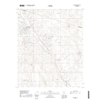
2018 Map of Wickenburg
USGS Topo · Published 2018About this map
The Hassayampa River carves a central path through this desert landscape, dividing the Wickenburg townsite from the surrounding peaks. In this modern survey, the town's street grid expands northward toward West Mtn while the Bnsf rail line parallels the river's course to the southeast. To the south, the settlement of Allah sits near the banks of Palm Lake, surrounded by a complex network of dry desert drainages including Mockingbird Wash and Cemetery Wash. The terrain is defined by the significant rise of the Vulture Mountains to the southwest and the Wickenburg Mountains in the northeast. Aviation infrastructure is noted at the Rio Vista Hills Airport, highlighting the region's continued growth beyond its traditional mining and ranching roots. High points like San Domingo Peak provide a framing for the alluvial washes that characterize the local topography.
Find a feature on this map
85 named features on this map. Tap any name to fly to it.
Don’t see what you’re looking for? This feature index may not catch every label — zoom into the map to look around manually.
Map Details
Editions of this 2018 Wickenburg Map
This is the sole edition of this map. No revisions or reprints were ever made.
Other maps of this area

1887 · Prescott
USGS Topo · 1:250,000

1892 · Prescott
USGS Topo · 1:250,000

1903 · Congress
USGS Topo · 1:125,000

1904 · Congress
USGS Topo · 1:125,000

1947 · Wagoner
USGS Topo · 1:62,500

1948 · Wagoner
USGS Topo · 1:63,360

1950 · Wagoner
USGS Topo · 1:62,500

1950 · Prescott
USGS Topo · 1:250,000

1954 · Prescott
USGS Topo · 1:250,000

1954 · Phoenix
USGS Topo · 1:250,000