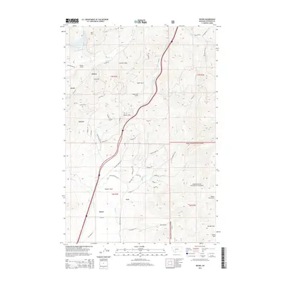
2014 Map of Wickes
USGS Topo · Published 2014About this map
The settlement of Wickes serves as a focal point in this mountainous region of Jefferson County, where the legacy of Montana mining is etched into the landscape. Roads like Alta Ore Mine Rd and Blue Bird Mine Rd lead into the high terrain near Alta Mtn, tracing the paths of early industrial extraction. The topography is defined by sharp gulches and creek beds, including Finn Gulch and Comet Cr, while the Wickes Tunnel stands as a significant engineering landmark near Portal. To the south, the valley widens toward Boulder Valley and the small clusters of Kyle and Rieder. This survey illustrates the modern intersection of the Deerlodge National Forest with historical settlement patterns, showing how transportation routes like Old Highway 15 follow the natural drainages of Beavertown Cr and Amazon Cr.
Find a feature on this map
60 named features on this map. Tap any name to fly to it.
Don’t see what you’re looking for? This feature index may not catch every label — zoom into the map to look around manually.
Map Details
Editions of this 2014 Wickes Map
This is the sole edition of this map. No revisions or reprints were ever made.
Other maps of this area

1886 · Fort Logan
USGS Topo · 1:250,000

1889 · Helena
USGS Topo · 1:250,000

1893 · Helena
USGS Topo · 1:250,000

1899 · Boulder
USGS Topo · 1:125,000

1899 · Helena
USGS Topo · 1:250,000

1903 · Helena
USGS Topo · 1:250,000

1947 · Butte
USGS Topo · 1:250,000

1948 · White Sulphur Springs
USGS Topo · 1:250,000

1950 · Devils Fence
USGS Topo · 1:62,500

1950 · Jefferson City
USGS Topo · 1:62,500