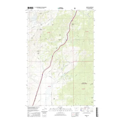
2017 Map of Wickes
USGS Topo · Published 2017About this map
Wickes and the surrounding drainage of Comet Cr anchor this high-altitude landscape in Jefferson County. The terrain is defined by a dense network of gulches—including Iron Ore Gulch, Spring Gulch, and Copper Gulch—that hint at the area's deep-rooted mining heritage. This 2017 survey shows the modern footprint of settlements like Jefferson City and Amazon, while tracing the historical infrastructure that once supported the region's industrial boom. A significant engineering landmark, the Wickes Tunnel, is located south of Portal, marking the passage through the mountains. To the east, the map captures the western edge of the Deerlodge National Forest and the broad expanse of Boulder Valley. The geography is further detailed by numerous family-named landmarks and watercourses such as Prickly Pear Cr and Muskrat Cr, which drain the eastern slopes of Alta Mtn.
Find a feature on this map
65 named features on this map. Tap any name to fly to it.
Don’t see what you’re looking for? This feature index may not catch every label — zoom into the map to look around manually.
Map Details
Editions of this 2017 Wickes Map
This is the sole edition of this map. No revisions or reprints were ever made.
Other maps of this area

1886 · Fort Logan
USGS Topo · 1:250,000

1889 · Helena
USGS Topo · 1:250,000

1893 · Helena
USGS Topo · 1:250,000

1899 · Boulder
USGS Topo · 1:125,000

1899 · Helena
USGS Topo · 1:250,000

1903 · Helena
USGS Topo · 1:250,000

1947 · Butte
USGS Topo · 1:250,000

1948 · White Sulphur Springs
USGS Topo · 1:250,000

1950 · Devils Fence
USGS Topo · 1:62,500

1950 · Jefferson City
USGS Topo · 1:62,500