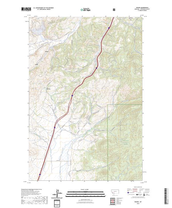
2024 Map of Wickes
USGS Topo · Published 2024About this map
Wickes and the surrounding mining-scarred landscape dominate this modern survey of Jefferson County. The town, along with Portal and Amazon, sits at the intersection of steep mountain drainages and historic transportation corridors like Old Railroad Rd. This terrain, rising toward Alta Mtn and the Boulder Mountains, is defined by its industrial past, where roads like Mt Tunnels Rd and Wood Chute Creek Rd hint at the timber and mining activities that once fueled the local economy.
Find a feature on this map
65 named features on this map. Tap any name to fly to it.
Don’t see what you’re looking for? This feature index may not catch every label — zoom into the map to look around manually.
Map Details
Editions of this 2024 Wickes Map
This is the sole edition of this map. No revisions or reprints were ever made.
Other maps of this area

1886 · Fort Logan
USGS Topo · 1:250,000

1889 · Helena
USGS Topo · 1:250,000

1893 · Helena
USGS Topo · 1:250,000

1899 · Boulder
USGS Topo · 1:125,000

1899 · Helena
USGS Topo · 1:250,000

1903 · Helena
USGS Topo · 1:250,000

1947 · Butte
USGS Topo · 1:250,000

1948 · White Sulphur Springs
USGS Topo · 1:250,000

1950 · Devils Fence
USGS Topo · 1:62,500

1950 · Jefferson City
USGS Topo · 1:62,500