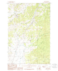
1985 Map of Wickes
USGS Topo · Published 1986About this map
Mining heritage and mountain geography define this mid-1980s survey of Jefferson County, where the settlement of Wickes sits amidst a landscape shaped by mineral extraction. Numerous labels for Prospect and Prospects are scattered across the slopes of Alta Mountain and the Boulder Hills, accompanied by industrial markers like a Mine Shaft and a specific tunnel Portal. The transportation history of the region is visible in the corridor of an Abandoned RR and the winding Stagecoach Road, indicating how shifting infrastructure once connected these mountain outposts to the broader territory.
Find a feature on this map
32 named features on this map. Tap any name to fly to it.
Don’t see what you’re looking for? This feature index may not catch every label — zoom into the map to look around manually.
Map Details
Editions of this 1985 Wickes Map
This is the sole edition of this map. No revisions or reprints were ever made.
Other maps of this area

1886 · Fort Logan
USGS Topo · 1:250,000

1889 · Helena
USGS Topo · 1:250,000

1893 · Helena
USGS Topo · 1:250,000

1899 · Boulder
USGS Topo · 1:125,000

1899 · Helena
USGS Topo · 1:250,000

1903 · Helena
USGS Topo · 1:250,000

1947 · Butte
USGS Topo · 1:250,000

1948 · White Sulphur Springs
USGS Topo · 1:250,000

1950 · Devils Fence
USGS Topo · 1:62,500

1950 · Jefferson City
USGS Topo · 1:62,500