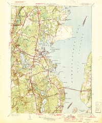
1944 Map of Wickford
USGS Topo · Published 1944About this map
The western shores of Narragansett Bay are captured in detail during the mid-1940s, revealing a landscape defined by coastal industry and strategic transit. The New York New Haven and Hartford railroad cuts through the western interior, linking Wickford Junction with the manufacturing and residential hubs of Lafayette and Davisville. Along the jagged coastline, Wickford Harbor serves as a focal point, guarded by the Wickford Lighthouse and surrounded by developed points like Shore Acres and Sauga Pt.
Find a feature on this map
89 named features on this map. Tap any name to fly to it.
Don’t see what you’re looking for? This feature index may not catch every label — zoom into the map to look around manually.
Map Details
Editions of this 1944 Wickford Map
2 editions found
Other maps of this area

1889 · Charlestown
USGS Topo · 1:62,500

1889 · Newport
USGS Topo · 1:62,500

1890 · Narragansett Bay
USGS Topo · 1:62,500

1890 · Kent
USGS Topo · 1:62,500

1892 · Narragansett Bay
USGS Topo · 1:62,500

1894 · Kent
USGS Topo · 1:62,500

1894 · Newport
USGS Topo · 1:62,500

1904 · Newport
USGS Topo · 1:62,500

1919 · Charlestown
USGS Topo · 1:62,500

1919 · Narragansett Bay
USGS Topo · 1:62,500