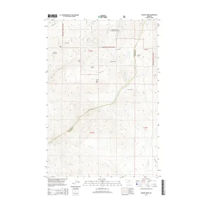
2014 Map of Wickiup Creek
USGS Topo · Published 2014About this map
Deerlodge National Forest dominates the northern reaches of this map, where the high terrain is defined by Negro Mtn, Moffet Mtn, and Pandora Mtn. The landscape is a complex network of drainage basins and gulches, with Soap Gulch and the Left Fork Soap Gulch carving paths through the northwestern peaks. Further south, the boundary between Silver Bow Co and Madison Co runs through the central valley, a significant marker for local researchers and genealogists tracing property lines and jurisdictional history in this part of Montana.
Find a feature on this map
24 named features on this map. Tap any name to fly to it.
Don’t see what you’re looking for? This feature index may not catch every label — zoom into the map to look around manually.
Map Details
Editions of this 2014 Wickiup Creek Map
This is the sole edition of this map. No revisions or reprints were ever made.
Other maps of this area

1893 · Dillon
USGS Topo · 1:250,000

1955 · Dillon
USGS Topo · 1:250,000

1957 · Dillon
USGS Topo · 1:250,000

1958 · Dillon
USGS Topo · 1:250,000

1960 · Twin Bridges
USGS Topo · 1:62,500

1961 · Melrose
USGS Topo · 1:24,000

1961 · Earls Gulch
USGS Topo · 1:24,000

1961 · Wickiup Creek
USGS Topo · 1:24,000

1961 · Nez Perce Hollow
USGS Topo · 1:24,000

1961 · Butte South
USGS Topo · 1:62,500