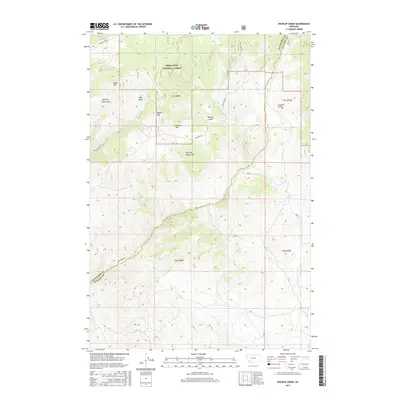
2017 Map of Wickiup Creek
USGS Topo · Published 2017About this map
Deerlodge National Forest dominates the northern reaches of this Montana landscape, where the high ridges of Negro Mtn and Moffet Mtn overlook a complex system of drainages. The topography is defined by significant elevation changes, falling from these summits toward the southeastern valleys through names like Soap Gulch and Sawmill Gulch. This 2017 survey details the rugged crossing of the Silver Bow and Madison County line, a boundary that follows the natural contours of the mountain range.
Find a feature on this map
25 named features on this map. Tap any name to fly to it.
Don’t see what you’re looking for? This feature index may not catch every label — zoom into the map to look around manually.
Map Details
Editions of this 2017 Wickiup Creek Map
This is the sole edition of this map. No revisions or reprints were ever made.
Other maps of this area

1893 · Dillon
USGS Topo · 1:250,000

1955 · Dillon
USGS Topo · 1:250,000

1957 · Dillon
USGS Topo · 1:250,000

1958 · Dillon
USGS Topo · 1:250,000

1960 · Twin Bridges
USGS Topo · 1:62,500

1961 · Melrose
USGS Topo · 1:24,000

1961 · Earls Gulch
USGS Topo · 1:24,000

1961 · Wickiup Creek
USGS Topo · 1:24,000

1961 · Nez Perce Hollow
USGS Topo · 1:24,000

1961 · Butte South
USGS Topo · 1:62,500