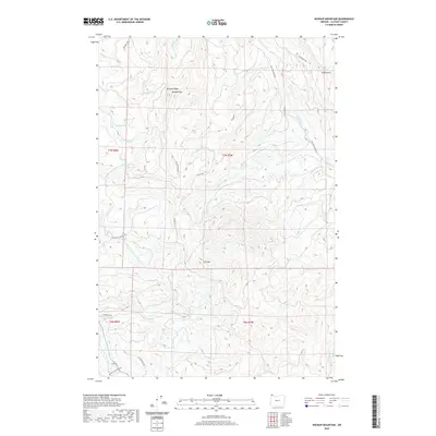
2020 Map of Wickiup Mountain
USGS Topo · Published 2020About this map
Wickiup Mtn and the adjacent Wickiup Ridge dominate this section of the Northern Oregon Coast Range, where the headwaters of several critical river systems emerge. The drainage patterns of the N Fork Klaskanine River and its various tributaries, including the Middle Fork N Fork Klaskanine River, shape the high-elevation landscape. Pockets of water like Middle Lake and Wickiup Lake are positioned among the timbered heights, accessible by a complex network of forest roads and historic transit corridors. Industrial history is evident in the naming of infrastructure such as California Barrel Rd and Cooperage Rd, reflecting the region's legacy of timber harvesting and wood product manufacturing. The presence of routes like the Big Creek Mainline and Youngs River Mainline further illustrates the established logging transit systems that have defined Clatsop County's interior for decades.
Find a feature on this map
36 named features on this map. Tap any name to fly to it.
Don’t see what you’re looking for? This feature index may not catch every label — zoom into the map to look around manually.
Map Details
Editions of this 2020 Wickiup Mountain Map
This is the sole edition of this map. No revisions or reprints were ever made.
Other maps of this area

1939 · Saddle Mountain
USGS Topo · 1:62,500

1940 · Svensen
USGS Topo · 1:62,500

1941 · Keasey
USGS Topo · 1:62,500

1941 · Cathlamet
USGS Topo · 1:62,500

1943 · Keasey
USGS Topo · 1:62,500

1943 · Saddle Mtn.
USGS Topo · 1:62,500

1948 · Vancouver
USGS Topo · 1:250,000

1949 · Cathlamet Bay
USGS Topo · 1:24,000

1949 · Green Mountain
USGS Topo · 1:24,000

1950 · Vancouver
USGS Topo · 1:250,000