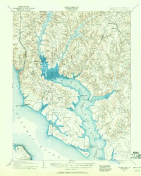
1911 Map of Wicomico
USGS Topo · Published 1961About this map
The Wicomico River dominates this landscape, serving as the tidal boundary between Charles County and St Marys County. This 1911 revision by R. L. Harrison and J. M. Harris documents the river-and-rail economy of Southern Maryland at a time when the Philadelphia Baltimore and Washington RR terminated at the water's edge in Popes Creek. Maritime commerce is evident in the numerous landings and structures along the shore, including Lancaster Wharf, Bushwood Wharf, and the Laidlow Ferry. Inland, established settlements like Charlotte Hall, Chaptico, and Newmarket follow the high ground between the river and the complex drainage of Zekiah Swamp Run and Chaptico Creek. The presence of small hamlets such as Dentsville, Faulkner, and Mt Victoria illustrates the rural, agricultural character of the region during the early twentieth century.
Find a feature on this map
67 named features on this map. Tap any name to fly to it.
Don’t see what you’re looking for? This feature index may not catch every label — zoom into the map to look around manually.
Map Details
Editions of this 1911 Wicomico Map
This is the sole edition of this map. No revisions or reprints were ever made.
Other maps of this area

1889 · Fredericksburg
USGS Topo · 1:125,000

1890 · Mt. Vernon
USGS Topo · 1:125,000

1891 · Mt. Vernon
USGS Topo · 1:125,000

1892 · Leonardtown
USGS Topo · 1:62,500

1892 · Fredericksburg
USGS Topo · 1:125,000

1892 · Prince Frederick
USGS Topo · 1:62,500

1892 · Brandywine
USGS Topo · 1:62,500

1892 · Piney Point
USGS Topo · 1:62,500

1892 · Montross
USGS Topo · 1:62,500

1894 · Wicomico
USGS Topo · 1:62,500