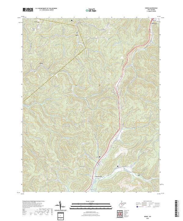
2023 Map of Widen
USGS Topo · Published 2023About this map
Widen and Hookersville serve as focal points in this 2023 survey of the Nicholas and Clay County border. The terrain is defined by the significant elevation of Powell Mountain and the prominent Corren Knob, with numerous narrow valleys carved by watercourses like Strange Creek and Muddlety Creek. The settlement pattern follows these winding drainage basins and ridgelines, connected by a network of rural routes such as Widen Dille Rd and the Hookersville Rd. Genealogy researchers can locate several family-linked sites and local burial grounds, including Butcher Cem near Dille and Hill Cem further south. The map documents the persistent rural character of these Appalachian communities, where small clusters of housing like Wattsville and Opal remain integrated into the complex topography of the Wilson Ridge area.
Find a feature on this map
76 named features on this map. Tap any name to fly to it.
Don’t see what you’re looking for? This feature index may not catch every label — zoom into the map to look around manually.
Map Details
Editions of this 2023 Widen Map
This is the sole edition of this map. No revisions or reprints were ever made.
Other maps of this area

1889 · Nicholas
USGS Topo · 1:125,000

1891 · Nicholas
USGS Topo · 1:125,000

1893 · Sutton
USGS Topo · 1:125,000

1901 · Nicholas
USGS Topo · 1:125,000

1908 · Gassaway
USGS Topo · 1:48,000

1908 · Sutton
USGS Topo · 1:48,000

1910 · Sutton Special
USGS Topo · 1:62,500

1910 · Gassaway
USGS Topo · 1:62,500

1913 · Summersville
USGS Topo · 1:48,000

1915 · Cowen
USGS Topo · 1:48,000