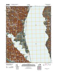
2011 Map of Widewater
USGS Topo · Published 2011About this map
Widewater and the surrounding Stafford County shoreline are defined by the convergence of Tank Creek, Boars Creek, and Aquia Creek as they enter the broad expanse of the Potomac River. This 2011 survey documents a landscape of established waterfront landings and modern residential developments, with distinct neighborhoods like Colonial Port, Sunshine View, and Windermere appearing alongside older agricultural references such as Thorny Point Farm. The presence of Aquia Landing and Willow Landing underscores the area's long history as a maritime transit point, while more recent infrastructure is represented by Hope Springs Marina and Chimney View Airport. Across the river in Maryland, Liverpool Wharf and Clifton Beach anchor a less densely developed bank. Military and recreational aviation also shape the region, with the northern edge featuring a portion of the Quantico Marine Corps Airfield/Turner Field.
Find a feature on this map
90 named features on this map. Tap any name to fly to it.
Don’t see what you’re looking for? This feature index may not catch every label — zoom into the map to look around manually.
Map Details
Editions of this 2011 Widewater Map
This is the sole edition of this map. No revisions or reprints were ever made.
Other maps of this area

1889 · Fredericksburg
USGS Topo · 1:125,000

1890 · Mt. Vernon
USGS Topo · 1:125,000

1891 · Mt. Vernon
USGS Topo · 1:125,000

1892 · Fredericksburg
USGS Topo · 1:125,000

1894 · Fredericksburg
USGS Topo · 1:125,000

1894 · Mt. Vernon
USGS Topo · 1:125,000

1897 · Mt. Vernon
USGS Topo · 1:125,000

1913 · Indian Head
USGS Topo · 1:62,500

1913 · Nanjemoy
USGS Topo · 1:62,500

1923 · Indian Head
USGS Topo · 1:48,000