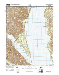
2013 Map of Widewater
USGS Topo · Published 2013About this map
The Potomac River dominates this landscape where Stafford County meets the Maryland shoreline, creating a wide expanse of water that shaped centuries of transport and recreation. Along the western shore, the community of Widewater serves as a hub for numerous residential developments and waterfront settlements like Arkendale, Saratoga, and Widewater Beach. The map details a transition from the structured grounds of Quantico Marine Corps Base in the north to the recreational landings and marinas further south. Numerous family-named landmarks and historical points of interest are visible, including the J A Macgregor Estate and Thorny Point Farm. The Potomac's indented shoreline is marked by prominent features such as Mallows Bay to the east and specialized sites like Youbedamn Landing and Aquia Landing, reflecting a deep connection to the river's maritime economy and leisure culture.
Find a feature on this map
110 named features on this map. Tap any name to fly to it.
Don’t see what you’re looking for? This feature index may not catch every label — zoom into the map to look around manually.
Map Details
Editions of this 2013 Widewater Map
This is the sole edition of this map. No revisions or reprints were ever made.
Other maps of this area

1889 · Fredericksburg
USGS Topo · 1:125,000

1890 · Mt. Vernon
USGS Topo · 1:125,000

1891 · Mt. Vernon
USGS Topo · 1:125,000

1892 · Fredericksburg
USGS Topo · 1:125,000

1894 · Fredericksburg
USGS Topo · 1:125,000

1894 · Mt. Vernon
USGS Topo · 1:125,000

1897 · Mt. Vernon
USGS Topo · 1:125,000

1913 · Indian Head
USGS Topo · 1:62,500

1913 · Nanjemoy
USGS Topo · 1:62,500

1923 · Indian Head
USGS Topo · 1:48,000